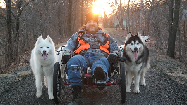
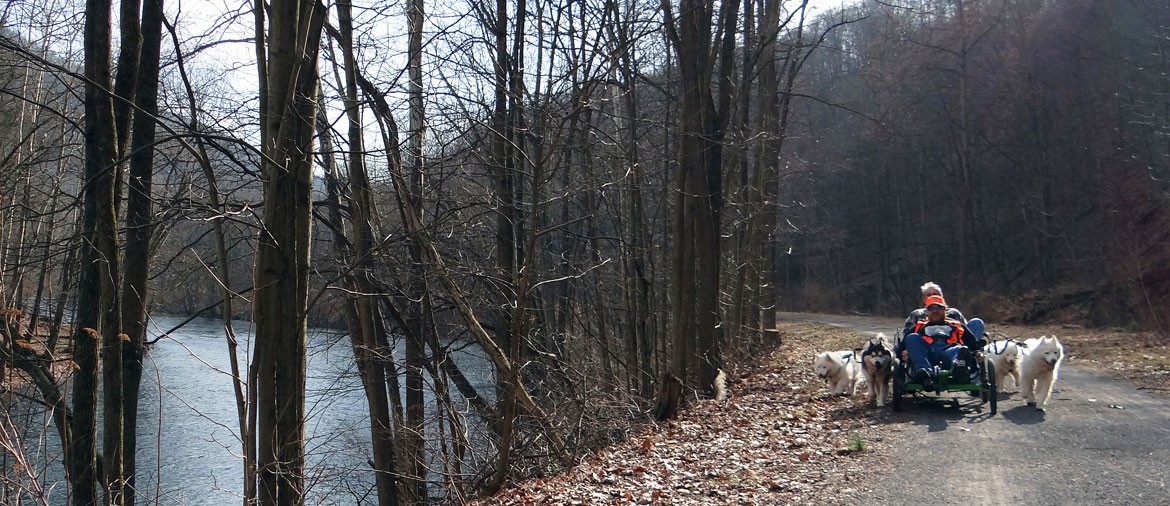
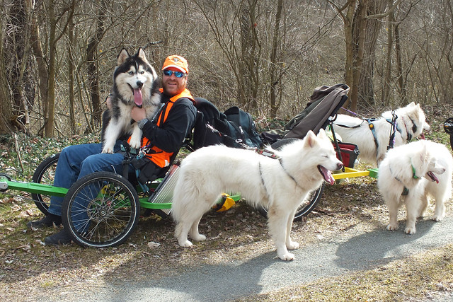
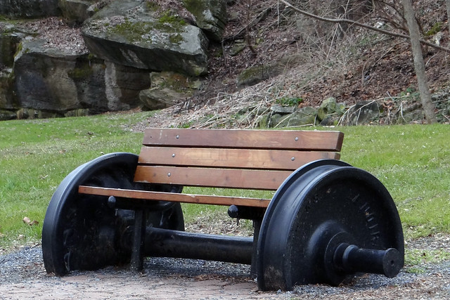
It was on December 28, 2011 when they WooFDriver took the WooFPAK for a mushing tour of the Lebanon Valley Rail Trail in Pennsylvania. The original railroad was built in the 1880’s to carry vacationers to the summer resort community of Mount Gretna. It also carried Pennsylvania National Guard to their training camp near Mount Gretna. Freight service continued on the main line until 1972 when Hurricane Agnes washed out sections of the track.
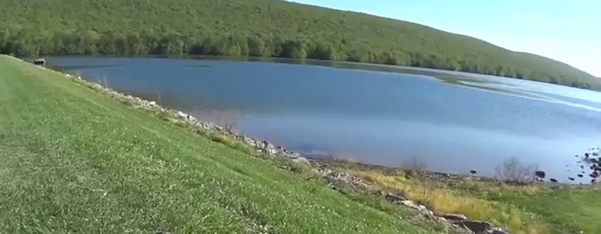
This trail follows the Conewago Creek from its beginnings, as it passes through the Conewago Lake and beyond. The creek is 80.2 miles long and flows into the Susquehanna River. It is a popular fishing destination and also a destination for canoeing and kayaking when the water is high enough despite the many dams along ride.
Wikipedia’s Webpage to learn more about this creek
Please enjoy this photo album for the WooFPAK’s mushing adventure!
On January 22, 2015 the WooFDriver took the WooFPAK on a Mushing tour of the Henry Hudson Trail in New Jersey. The 24 mile long trail is not near the Hudson River, but named after Henry Hudson to honor the man who explored the highlands and coastline in the early 1600s. Unlike most rail trails, this railroad line was never officially abandoned, it leases the line for trail usage to the park system.
The Henry Hudson Trail parallels the Sandy Hook Bay. Triangular in shape, it is an extension of the Raritan Bay. The Shrewsbury River feeds the bay that serves as a harbor for both the US Coast Guard and the US Navy.
Wikipedia’s Webpage to learn more about the bay and surrounding waterways
Please take a look through the photo album of the WooFDriver’s adventure!
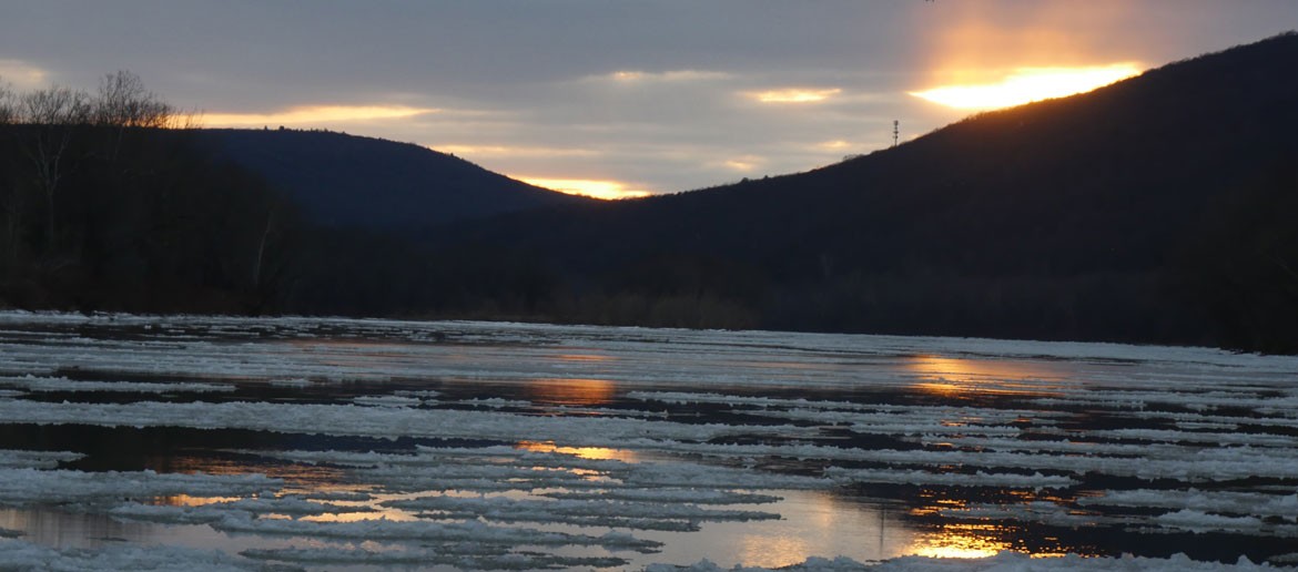
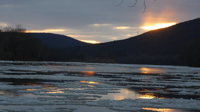
On January 21, 2016 the WooFDriver and his crew took the WooFPAK on a Mushing tour of the Susquehanna Warrior Trail in Pennsylvania. The trail passes by the town of Hunlock, named after Johnathan Hunlock who arrived in the area in the early 1770s to build a plantation on the creek. The Hunlock creek was known as Massacota to the Native Americans who used the warrior trail as a footpath.
The trail is named after the river it follows, the Susquehanna River. It is the longest river in eastern United States that empties into the Atlantic Ocean at 464 miles long. It is also one of the oldest rivers in the world! The name Susquehanna is a Native American name meaning Oyster River, referring to the abundant oysters in the Chesapeake Bay were the river empties into.
Wikipedia’s Webpage to learn more about the Susquehanna River
Enjoy the photo album from the trip!
Also enjoy the video footage from this mushing adventure!
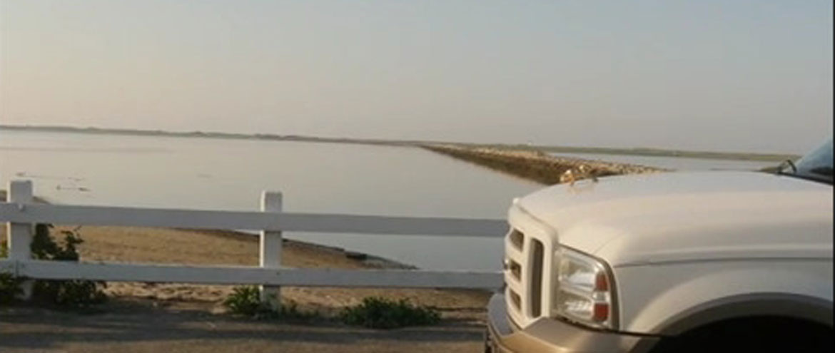
July 28, 2015 the WooFDriver and his crew took the WooFPAK for a Midnight Mushing tour of the Cape Cod Rail Trail. The original rail line was constructed by the Old Colony Railroad in operation from 1845 to 1893, then later incorporated into the New York, New Haven & Hartford Railroad from 1872 to 1968.
The rail trail runs in the middle of Cape Cod, in between the Atlantic Ocean and the Cape Cod Bay. The bay is 604 square miles in mass and the most southern part of the Gulf of Maine. In 1524 the first European navigator is said to have discovered the bay.
Wikipedia Webpage to learn more about Cape Cod Bay
Enjoy these videos from the mushing adventure!
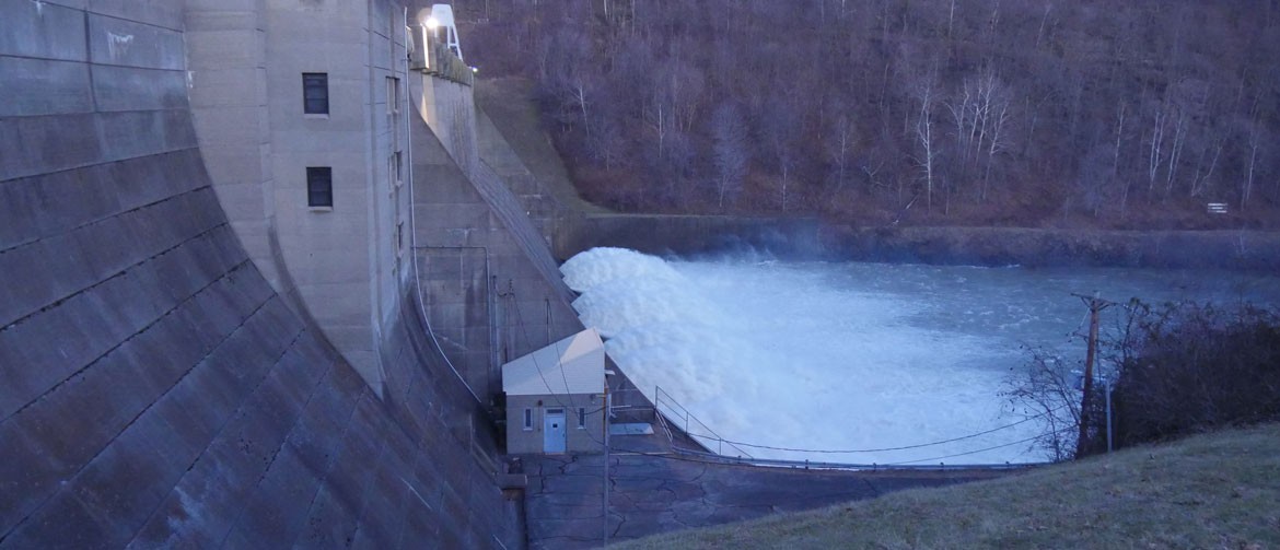
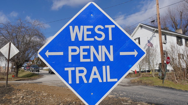
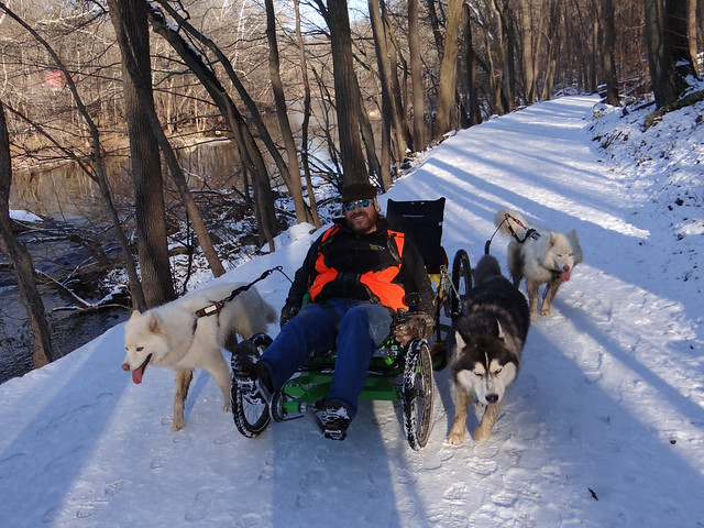
On February 6, 2016 the WooFDriver took the WooFPAK on a Mushing adventure of the West Penn Trail in Pennsylvania. The 17 mile long trail runs along the corridor that the Portage Railroad line used from 1830 to 1864 connecting the cities of Pittsburgh and Harrisburg.
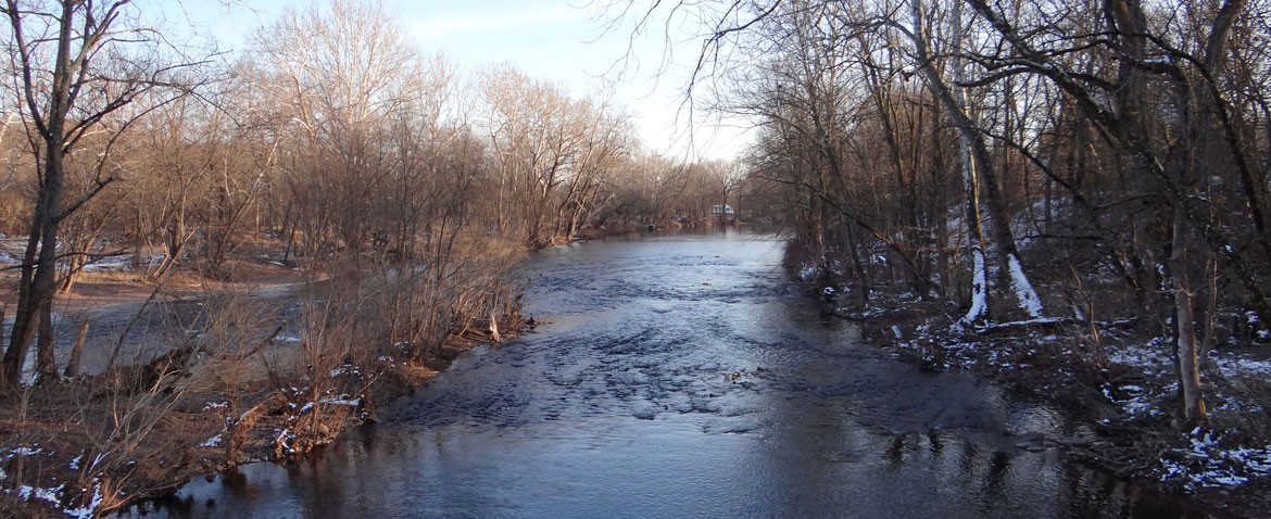
The trail follows beside the Conemaugh River and passes by its amazing dam! The dam was completed construction in 1952 for flood control purposes. The 70 mile long river’s name comes from the Native Americans and has the meaning of “Otter Creek”. This tributary of the Kiskiminetas River is in the heart of western Pennsylvania’s historic coal producing areas.
Wikipedia’s Webpage to learn more about this river
Enjoy the photos from the adventure!
Also enjoy video footage of the fun!
It was February 8, 2012 when the WooFDriver took the mushing tour with the WooFPAK of the Perkiomen Trail in Montgomery, Pennsylvania. The history of Perkiomen Trail railroad corridor is more than 140 years. The Perkiomen Railway Company started transportation in 1868 and ceased operation by 1955. It was used mostly for transportation to recreational areas for vacations.
The Perkiomen Trail is named after the 37.7 mile long Perkiomen Creek that runs beside the trail. This tributary of the Schuylkill River was once named the Perquaminck Creek on a 1687 Thomas Holme’s map. The name Perkiomen is from a Native American term that is translated into English to mean ‘cranberry place’.
Wikipedia’s Webpage to learn more about the Perkiomen Creek
Please check out the photo album for the WooFDriver’s mushing tour!
In May of 2015 the WooFDriver set out on a Mushing tour of the SwitchBack Trail in Pennsylvania with the WooFPAK. A rail trail of the once Switchback Railroad, which was the second railroad in America and the first in Pennsylvania. From 1870 to 1929 the railroad became a popular tourist attraction as it thrilled riders with rides of 50 miles per hour down through the Lehigh Valley. This railway takes credited for inspiring the creation of the roller coaster!
The trail passes by the Mauch Chunk Lake, a man made lake resulting from the damming of the Mauch Chunk Creek over 40 years ago. Now it is a favorite fishing lake but it was made to prevent the constant flooding hazard the creek posed to the town of Jim Thorpe. The dam was built just in time to save the town from the floodwaters of Hurricane Agnes.
http://www.tnonline.com/2012/jun/25/mauch-chunk-lake-turns-40 to learn more about the lake
Please enjoy videos from the WooFDriver’s adventure!
On March 7, 2012 the WooFDriver took the WooFPAK on a mushing tour of The Lower Trail in Blair, Pennsylvania. The history of this corridor goes back to the 1830’s, as part of the Pennsylvania Canal. This was a system of waterways connecting Philadelphia to Pittsburgh used to transport goods.
Along The Lower Trail runs the 104 mile long Juniata River, the second largest tributary of the Susquehanna River. Native Americans lived in the river’s valley until a treaty was made in 1755 that let white settlement east of the Allegheny Ridge. Angry natives raided these settlements, killing over 3,000 settlers. In present day the river is a popular destination for recreational purposes as canoeing, kayaking and fishing.
Wikipedia’s Webpage to learn more about the Juniata River
Here are videos from this mushing adventure!
Please take a look at the photo album from this mushing adventure!
January 10, 2012 the WooFDriver went on a mushing tour with the WooFPAK on the Ironton Rail Trail in Allentown, Pennsylvania. This trail was originally home of the Ironton Railroad that began operation in 1860 to transport iron ore from the Ironton mines to the Lehigh Valley Railroad. It served the local cement mills after the iron ore industry dried up. The railroad finally fell into disrepair in 1984.
This rail trail parallels Coplay Creek for its majority while also passing several small lakes. There is also a portion of the trail that rides beside the Lehigh River. Coplay Creek is 14.1 miles long and flows into the Lehigh River. The name came from “Kolapechka”, the son of a Native American Chief who lived at the beginning of the creek.
Wikipedia’s Webpage to learn more about this creek
Wikipedia’s Webpage to learn more about this area
Here are videos from this mushing adventure!
Please check out the photo album from this mushing adventure!
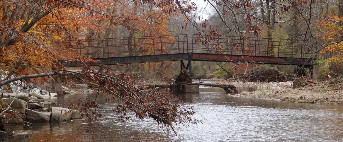
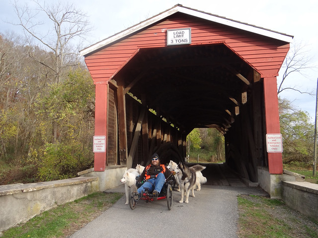
The WooFDriver on November 2, 2012 took the WooFPAK to the Fair Hill NRMA trails. This park is 5,656 acres and was one of the largest private land holdings in the East. Formerly owned by William DuPont, Jr., it was purchased by the state in 1975. The Foxcatcher Farm Covered Bridge received the State’s Historic Civil Engineering Landmark Award in 1994. This bridge is one of only two covered bridges in Cecil County, Maryland and goes over Big Elk Creek.
Big Elk Creek joins Little Elk Creek to make Elk River which then flows into the Chesapeake Bay. Elk River is about 15 miles long and the most northeastern extension of the Chesapeake Bay estuary. It is here where boats enter the Chesapeake and Delaware Canal which was built in the 19th century.
Wikipedia’s Webpage to learn more about Elk River
Here is some video footage from the trails!
Check out the photo album from the adventure!